Lake nipissing beading project, 2019-Ongoing
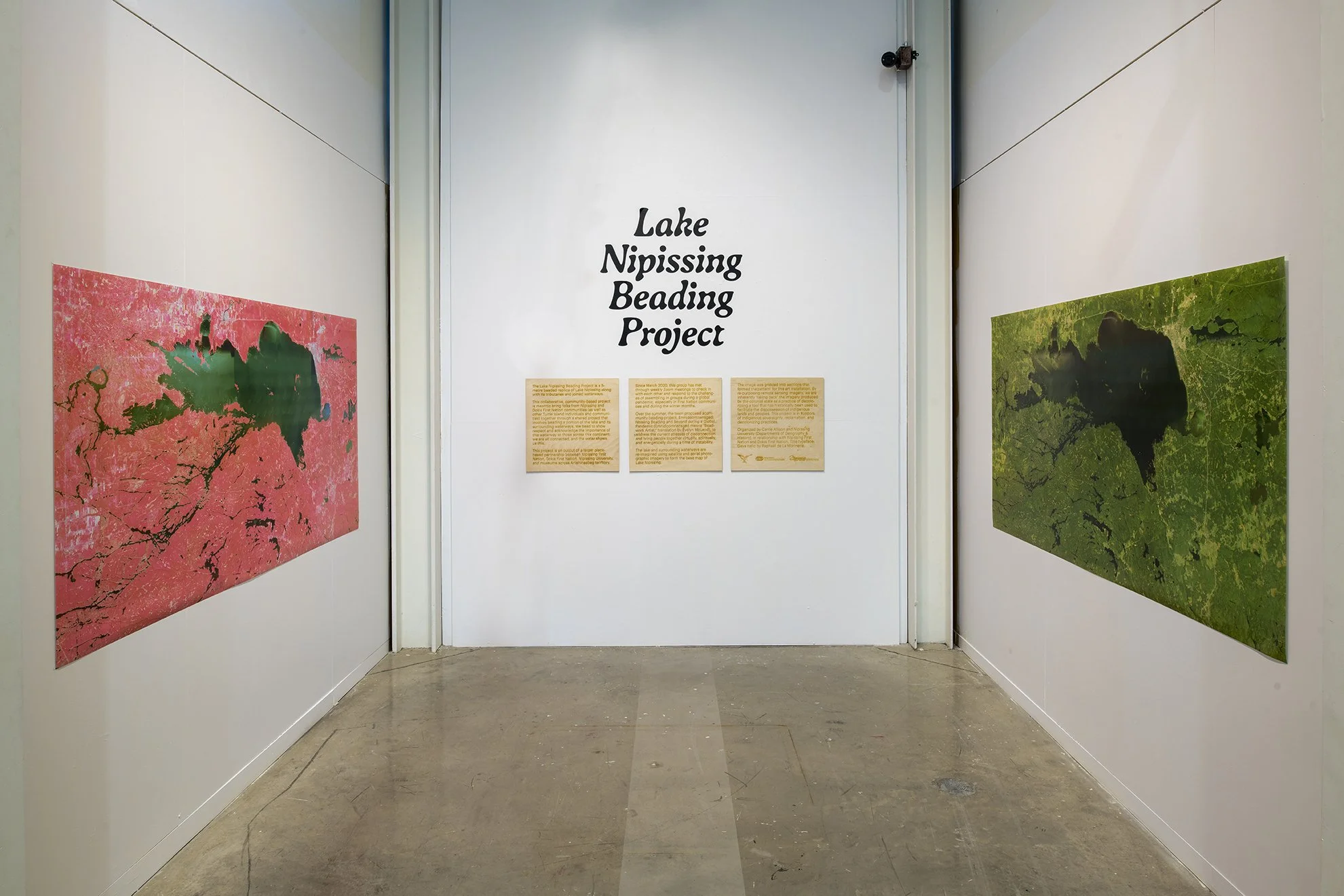
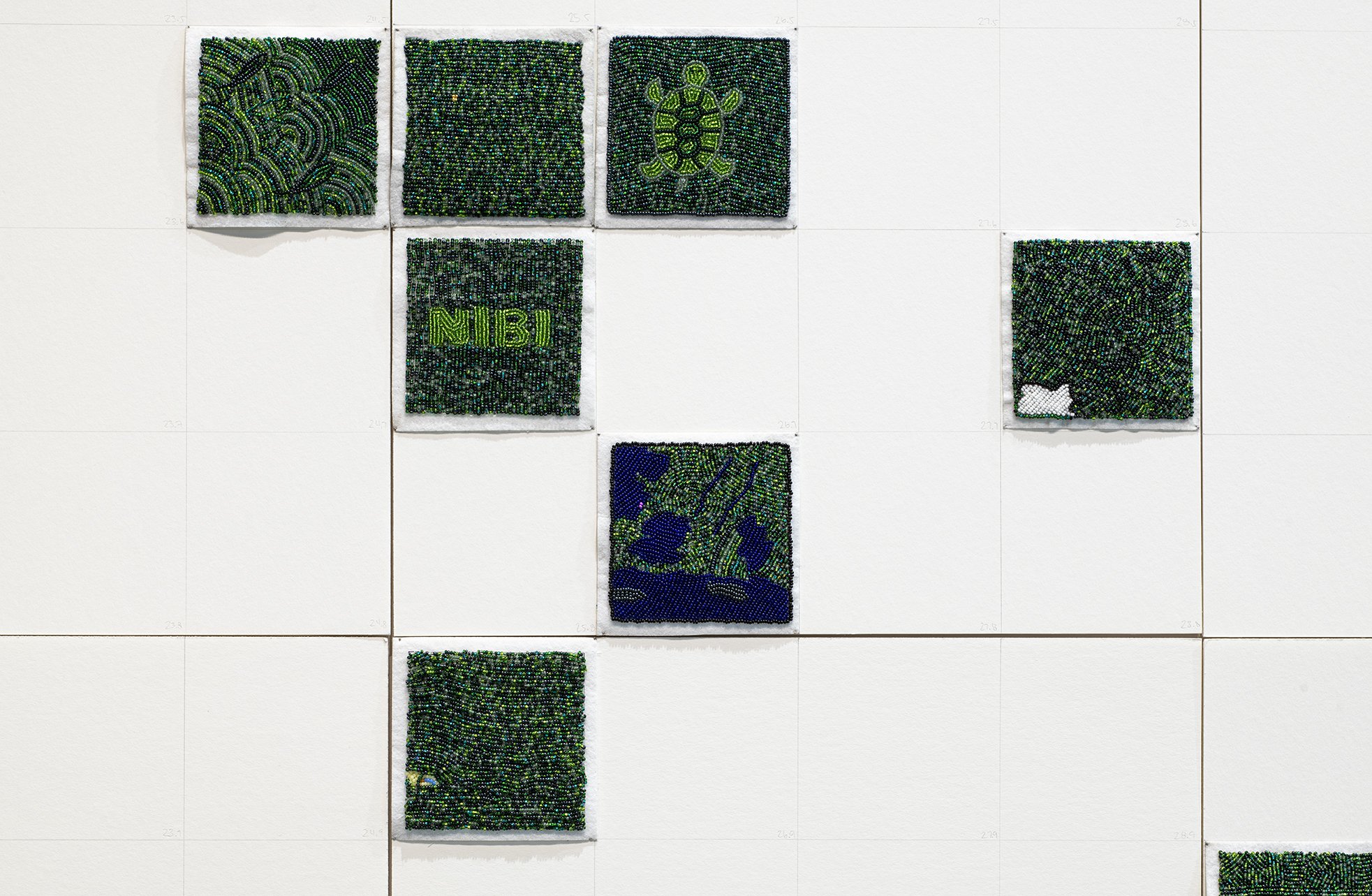
The Lake Nipissing Beading Project is a sister project to the Shubenacadie River Beading Project. It is a 10 meters reimagining of Lake Nipissing along with its tributaries and waterways using 444 individually beaded pieces. This community collaborative project is meant to bring folks from Nipissing and Dokis communities together through a shared project, as well as other Turtle Island individuals and communities to bead a portion of the lake and its surrounding waterways. We bead to show respect and acknowledge the importance of this waterway to those across this continent, we are all connected and the water shows us this. Map making has historically been used to disenfranchise and take land from Indigenous peoples across the globe. This project uses map making technology to take some of that power back by beading over it, with the beads standing in for Indigenous sovereignty. Water has always been a part of Indigenous territories and Indigenous ways of existing. In beading Lake Nipissing together, we honour the connective features of water, land and community. Water is life. Organized by Carrie Allison and Nipissing University’s Departments of Geography & History, in partnership with Nipissing First Nation and Dokis First Nation.This is a digital map with beaded pieces overlaid to show you a digital rendering of the installation of Lake Nipissing Beading Project, currently underway. This map has been created by assigning coordinates to the corners of the tiles so they can be overlain on their real-world locations, using a GIS (short for Geographic Information System). GIS technology is used to create, analyze and display spatial data, and has largely replaced manual cartography techniques. A GIS is a powerful tool for map-making, and like any map making technology has great potential for both harm and benefit.
For more information please visit https://www.lakenipissingbeadingproject.com/